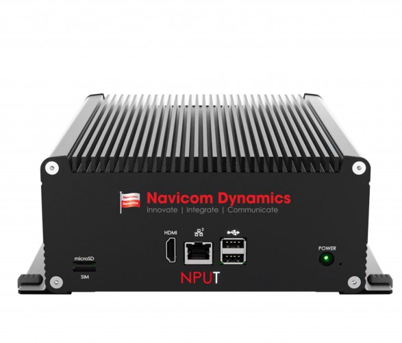
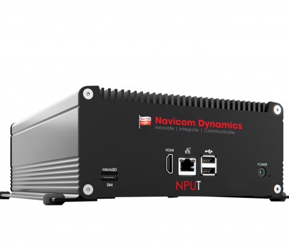

NPUT
Receive accurate, real-time vessel dynamics on any number of screens, giving the navigational crew and key personnel the information they need to synchronise operations and maintain clear communication.
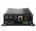
Navicom Dynamics’ Non-Portable Positioning Unit for Tugs (NPUT) is purpose-built for permanent installation on tugs. Compact and robust, it delivers high-precision position, heading, speed, and rate-of-turn data, with optional inputs for depth and towing-winch information.
Designed to enhance situational awareness, the NPUT supports both pilots and tug masters:
- Pilots can monitor tug position and movement with high accuracy, particularly valuable when line of sight is restricted.
-
Tug masters gain clear, real-time insight into the movement of the assisted vessel—especially helpful if radio contact with the pilot becomes limited or unavailable.
The NPUT has been selected by the Panama Canal Authority for their tug operations after a competitive international tender.
Known for its demanding operational environment, the Panama Canal requires technology that ensures safe, efficient manoeuvring in all conditions. The NPUT meets this standard—engineered to be precise, robust, and reliable for the world’s most challenging waterways.
Features
Performance Features & Usability
Independent of vessel: The system is entirely independent of the vessel. It is a secondary source of vessel of vital vessel information that supports critical decision-making during manoeuvres.
Critical information source/data points: Get accurate Position, Heading, Rate-of-turn, COG, SOG and other useful source/data points data to create a stable image of the vessel on the chart display software with optional future vessel path predictions.
Situational awareness: Enhanced awareness of the vessel and its surroundings, available on as many displays as needed to keep the entire crew informed.
Portability: Information available on portable displays (tablets/iPads), allows the crew to easily walk around the bridge wing or any location that has been set up.
Extendibility: Add-on any number of screens to interface with NPUT to provide the same accurate & real-time information to additional crew members for a synchronised operation. Add-on shore based data points from a server to the software to appear as integrated information to the user.
Premium Quality: High quality sensors with advanced technology to form state-of-the-art systems that are accurate, reliable and user-friendly.
User-oriented, feature-rich software: A number of useful features to improve training, usability, safety and for personal enhancement.
Specifications
Physical Specifications
- Dimensions: 186 x 81 x 250mm (WxHxD)
- Weight: 3.5 kg
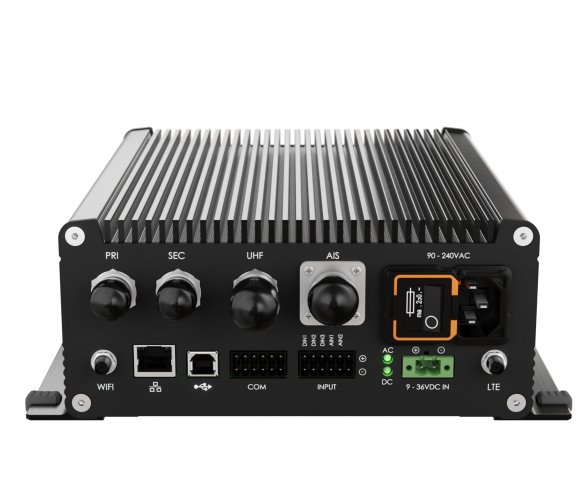
- Power requirements: 90-240 VAC 1A / 24 VDC 1A
- Battery Back-up: > 8 hours of operation
- Indicators: Diff lock, Diff RX, Heading, GNSS, Power, WiFi, AIS, UHF, Battery
Technical Specifications
GNSS
- Position source (Frequencies): L1C/A, L2C, L1OF, L2OF, E1, E1B/C, E5b, B1l, B2l
- Tracked systems: GPS, QZSS, Galileo, GLONASS, BeiDou
- Correction source: RTCMv3 (NTRIP/UHF), SBAS
- Position accuracy: RTK: 0.01m +/s 1ppm CEP, SBAS: 1m
- Heading: HDG Accuracy: < 0.02° (10m baseline)
- Rate of Turn: ROT Accuracy: < 0.1°/min
RTK/DGNSS Corrections
- Network corrections: NTRIP (via WiFi)
- UHF corrections: Using RTCMv3 over UHF connection
IMU (Inertial Measurement Unit)
- IMU Gyro Bias Instability: < 1°/hr (0.4-0.7°/hr typ.)
- IMU Angular Random Walk: ≤ 0.08°/√hr
UHF Radio
- Pre-tuned to 454.325 MHz using TrimTalk 450S to receive RTCMv3 DGNSS corrections
- Frequency range: 410 – 480 MHz
- Occupied bandwidth: 6.25, 12.5, 25 kHz
- Modulation type / Protocol: GMSK, Trimtalk 450S (+ others on request)
- Receiver Sensitivity: < -115dBm
AIS Receiver
- Dual frequency: 161.975 & 162.025 MHz
- Receiver Sensitivity: < -107dBm at 20% packet error rate
Wi-Fi
- Access Point: IEEE 802.11 a/b/g/n
- Number of clients: 10
- Security: WPA2
- Output power: 18 EIRP [dBm]
- Receiver Sensitivity: < -82dBm
Data / Connectivity
- Data output (NMEA/AIS): GGA, VTG, HDT, ROT, GSA, GSV, VDM
- Data protocol: NMEA-0183 (compatible with Trelleborg SafePilot)
- Connectivity: Wi-Fi, Ethernet (optional)
External Interfaces
- GNSS Antennas x2: TNC Jack
- UHF Antenna: N Jack
- VHF Antenna: SO239 Jack (mates to PL259)
- Wi-Fi Antenna: RP-SMA Jack
- USB (device only): USB Type B
- Mains power: 3-pin IEC C14 Inlet
- DC power: 2-pin Terminal Block w Screw Lock
Environmental Specifications
- Operating Temperature: -20°C to +74°C (-4°F to +165°F)
- Storage Temperature: -40°C to +85°C (-40°F to +185°F)
- Humidity: 95% (non-condensing)
- RoHs: NPUT meets the directive for Restriction of Hazardous substances